About ERATOSTHENES Centre of Excellence
A Centre of Excellence in Earth Observation and Geoinformatics offering cutting edge tools for Disaster Risk Reduction and Disaster Management.
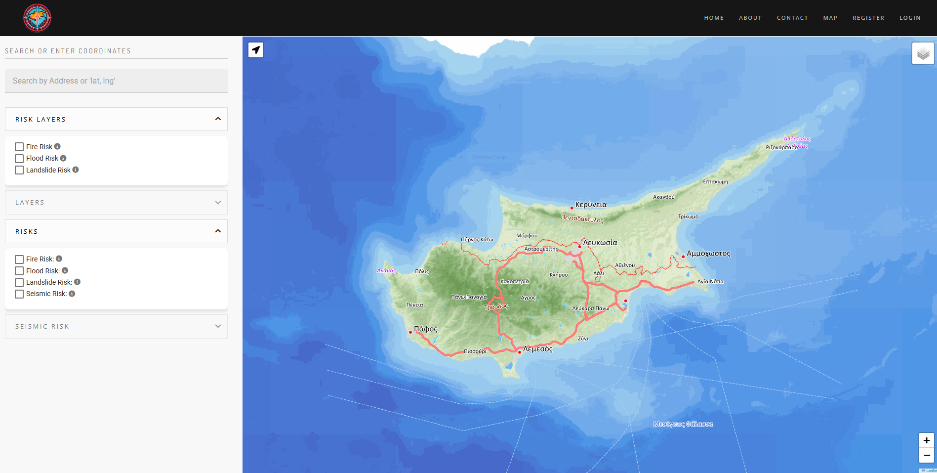
About the “NADI-RISK assessment platform”
The Natural Disaster Risk Assessment tool leverages cutting-edge Earth Observation and Geographic Information Systems technologies to provide accurate and actionable disaster risk assessments for earthquakes, landslides, fires and floods.
The goal is to reduce financial losses, improve disaster preparedness, and support sustainable urban planning by offering an innovative and user-friendly risk assessment platform.
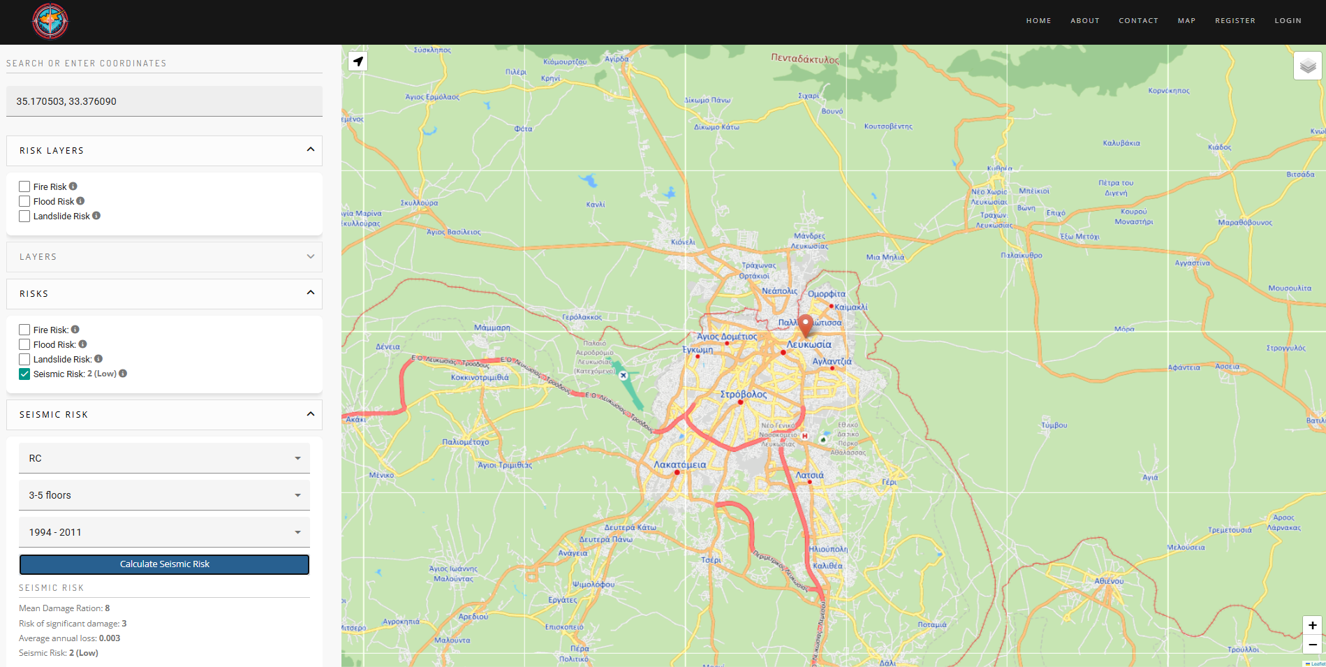
SEISMIC risk
The seismic risk tool uses event-based probabilistic seismic risk analysis and eventual selection of seismic scenarios for given return periods. The exposure model employed is built and elaborated by local resources and the vulnerability model developed for local building typologies, such as building height, year of construction and construction material.
Risk is expressed in terms of monetary loss, at national level and for the largest urban areas, and is provided in aggregated values as well as distributed along the island with map representation. For the selected scenarios, with 475 and 2500 years return period, expected casualties and displaced population are also estimated.
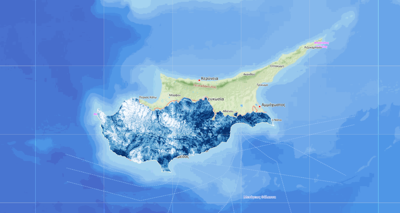
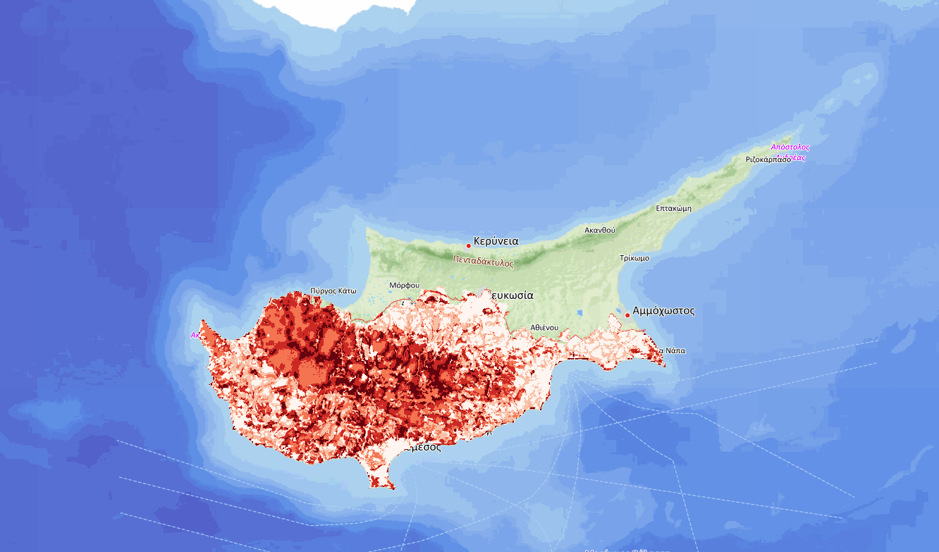
LANDSLIDE risk
Landslides are one of the most devastating disasters with significant impact to critical infrastructure, such as buildings and roads, as well as houses and utilities.
The landslide risk tool uses a Multi-Criteria Decision Analysis method combining key factors causing landslides. Data from various sources, like satellite images, Digital Elevation Models, geological surveys, precipitation records, etc., were utilised to determine the vulnerability and risk at a national scale.
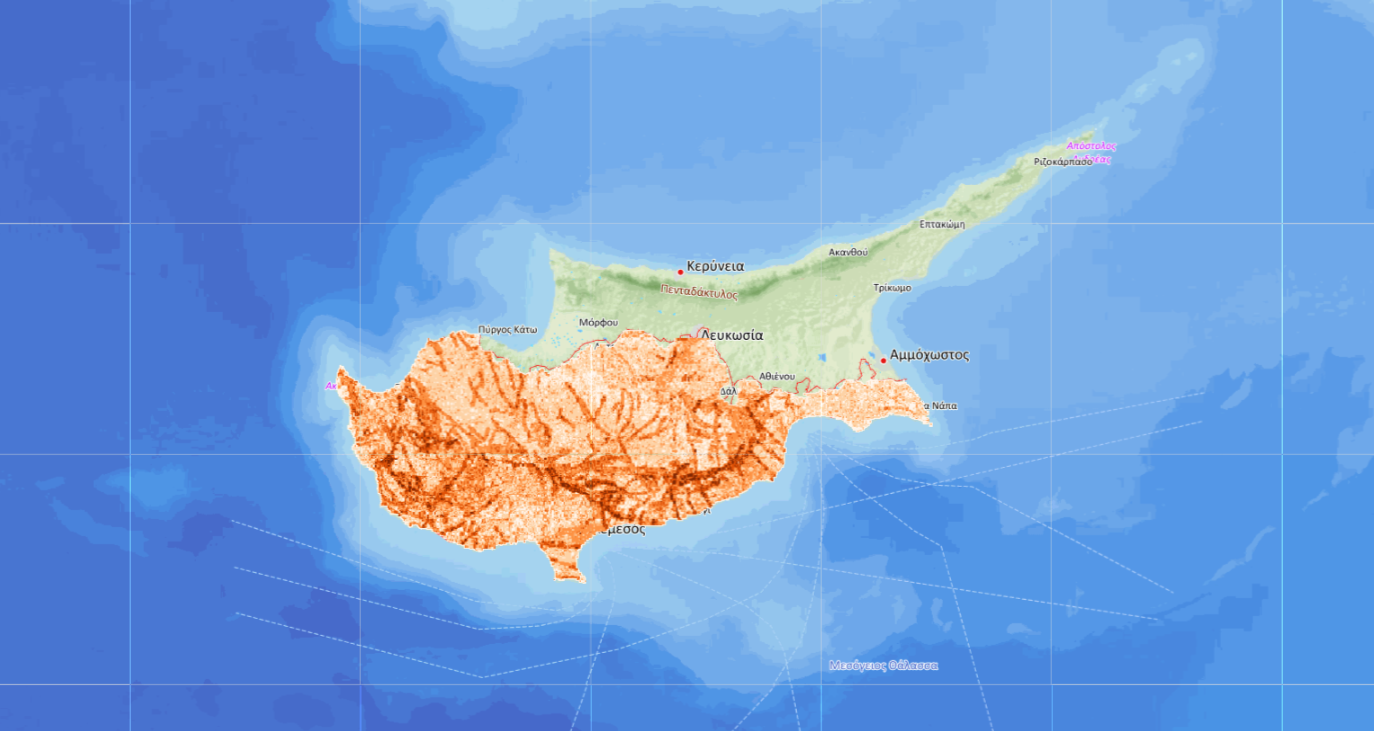
Fire risk
The fire risk tool provides an advanced fire risk assessment using multi-criteria decision analysis. By integrating satellite data, topographical information, and historical fire records, we deliver accurate fire susceptibility insights.
Key datasets include Sentinel-2 indices (NDVI, NDWI), EFFIS fire history, land cover, road networks, and temperature data. Designed for researchers, policymakers, and emergency responders, our tool supports data-driven decision-making to mitigate fire risks and enhance preparedness.
FLOOD risk
Flooding is the most disastrous natural phenomenon with respect to the frequency of occurrence and the number of humans which are negatively affected.
Topographical, soil, and meteorological information are used to estimate the spatial variation of the probability of flood occurrence in Cyprus via analytical hierarchical process. The opinions of multiple experts have been used to evaluate the relative significance of the flood-related factors.